Road Dust
American Rat Rider


<< Previous 1 2 3 4 Next >>   
Mexico - 2011
Wednesday - April 20, 2011

Cedral, San Luis Potsi to San Miguel de Allende, Guanajunto

268 miles -- Total miles: 1,925


Today was one of the good days.

Yesterday evening we had started up the road to Real de Catorce. The road going up the mountain to the town was 14 miles. It was also embedded with softball size rocks and the road was rutted. It took me about 100 yards to make the decision that I did not want to do 28 miles of this road so we made the decision to go back to Cedral and call it a day.

While having dinner at the restaurant, the lady who owned the restaurant found out from Mark about our failed attempt to ride up to Real de Catorce and made arrangements with her son to have him drive us up.

The town was a silver mining town in the 17th century. More recently it has been used in the making of movies including "Zorro", "The Mexican", and "Banditas".

Carlos picked us up at 7:30 this morning and drove us up to the town. The entrance to the town is through a 2 mile long tunnel that was used to bring the silver ore out of the mines. We were parked at the entrance of the tunnel waiting for our turn to go through and in less than a minute we had 3 young senoritas in the back of the truck. They were real beauties, Mexican Cuties, how they got there, I will never tell. Besides Mark and I are both married and my wife is also reading this thread.


It was our turn to go through the tunnel so Carlos drove us to the other end. The Mexican Cuties got out of the back of the truck, said "Gracias" for the ride and went on their way. That is the story that we are telling our wives, and we are sticking to it.


Many buildings in the town are several hundred years old. Also there have been several new "old" buildings added. It turned out to be a very interesting tour.


Carlos drove us back to downtown Cedral and showed us where the local money changer was at. By the time went back to our motel, loaded the bikes and returned to the downtown section, the money changer was open. A quick exchange and we now have Pesos so we can get back home next week. We got back on the bikes and headed south.


We have learned not to depend on road numbers, but to navigate by the names of the larger towns that are in the general direction that we are headed. The GPS was a good aide but was not dependable. Again, sometimes it worked, sometimes it did not. Sometimes it would give us correct information, and at other times it would show us 1-2 miles off the road.

Another important thing to remember when driving on two lane roads is to always stay to the far right. The center of the road is used as a passing lane. The biggest vehicle seems to have the right of way if it's driver decides to pass.

This afternoon we arrived in San Miguel de Allende which is a very unique town. It gives you a taste of "old Mexico”. There are a lot of old buildings, churches, numerous vendors, street vendors, hotels, and cafes. Several photos to follow later after I get them uploaded. All of the streets have either flat stones or the softball size rocks embedded in the street. Several of the streets are steep, but so far they have not been rutted.


They are currently in the middle of Holy Week here so the downtown area has been filed with activity and people.


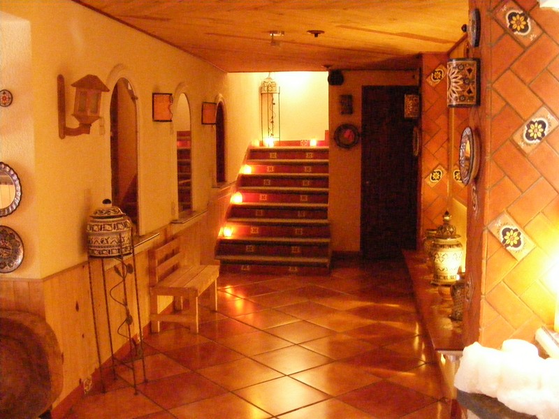
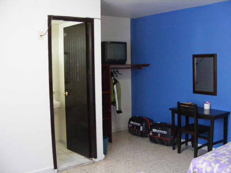
We got another great motel tonight (also cheap $55) that is located just a block or two from the town center.


We went through two military checkpoints yesterday. Today we went through one military checkpoint and one police road block. We were waved through at all four points. No one asked to see our tourist visa or our brand new vehicle import sticker. When do we get to show those off? After all, they were not exactly cheap.

Mexico - 2011
Thursday - April 21, 2011

San Miguel de Allende, Guanajunto to Tlaxcala, Tlaxcala

236 miles -- Total miles: 2,161


Today was just about getting from point A to point B. Congestion, traffic, and in the smaller towns, congestion, traffic, people celebrating Holy Week, road construction, and topes (sleeping policeman, speed breakers). The topes were really giving the bash plate on the Vee a good bashing. Around half of them would hit the bash plate. Same scenery as the last few days. Not one of the better riding days.


The highlight of the day was that we were seeing the local volcano in the not too far distance. The last time that it had erupted was three years ago, but was mostly smoke and ash.


The road construction and the smaller towns really slowed us down and it made for a long day. We made it into Tlaxcala around 8:30 and were running straight into a thunder storm. The first hotel that we stopped at did not have any vacancy, but they had a sister hotel a few blocks away that still had rooms left. We were given an escort over to the second hotel and got settled in for the night. This was by far the best hotel that we have stated at and it was only around $55 a night.


Tlaxcala city was founded between 1519 and 1524 when the Spaniards constructed their first buildings.

Mexico - 2011
Friday - April 22, 2011

Tlaxcala, Tlaxcala to Huajuapan de Leon, Oaxaca

226 miles -- Total miles: 2,387


We got a little earlier start this morning. Mark is meeting his wife at the airport this afternoon so he headed to Mexico City.

I took the cuota (toll) road to save some time and headed south east. Neither the GPS or the atlas had the cuota road leading into Oaxaca. However the map that I was using to travel by did show the road. I took the cuota road down as far as Tehuacan before I turned off on the libre (free) road Hwy 125 leading to Huajuapan de Leon. The GPS knew about this road, but a times it would show me 5-10 miles off of the road. Hwy 125 changed my whole day. This was what I came down here for. Mountains 4,000 to 7,000 feet high. Very light traffic and curves, curves, and more curves. And did I mention that the road also had plenty of curves? They were a few small towns along the way, and of course they had their topes. However, there was almost no traffic so it did not take that much longer to get through the towns, unlike yesterday.


I got into Huajuapan de Leon early this afternoon, got gas and decided to call it a day. If the map is correct (and we know how accurate it is), it was about another 5 hours through the mountains to the next town where I would hopefully be able to find a hotel. Not wanting to take a chance on it getting dark (you do not ride at night in Mexico) and not being able to find a hotel, I decided to play it safe, stop for the night and work on my ride reports including getting some pictures ready to upload. No internet again so every thing will have to wait to be posted online.


I was sure that they spoke Southern down here, but once again it appears that Spanish is the spoken language.

Some things that I learned on my first day of riding solo:

First thing is to say "No habla espanol". Most people smile, laugh at you, and then are very helpful.

So far I have been able to get gas without any problem. Seems to be the easiest thing to do. The gas pump shows you how much you owe.

I can buy things at the stores. They either count out on their fingers how much I owe, or I give them a bill larger than what I think I owe and receive my change back.

I managed to get a hotel tonight. They may have taken advantage of me though. It cost me $17 and I even have my own covered private parking in front of the room. The room is better than an average Motel 6 in the states and much cleaner.

I managed to order dinner tonight. I am not sure what I ordered but I was not expecting what I got. However, it was very good and there was more than twice as much food as what I could eat. Best baked fish that I have ever had, soup, bread, chips, salad, desert, and drink. Dinner set me back almost as much as $5.00.

It will be interesting to see what tomorrow brings.

Mexico - 2011
Saturday - April 23, 2011

Huajuapan de Leon, Oaxaca to Santiago Pinotepa Nacional, Oaxaca

209 miles -- Total miles: 2596


Today was a continuation of yesterday. I left Huajuapan de Leon and soon turned on Hwy 125 heading south toward the coast. It was more mountains and curves. I started out with cactus and an arid landscape which turned into pine trees and hardwoods complete with what appeared to be Spanish moss and ended up semi-tropical.


At least half of the road today was what I would classify as unmaintained. For around 100 miles the road had continuous potholes, broken pavement, and no payment. In two cases the road had washed away. The first time half of the road was gone and was replaced by a 50 foot hole going down the side of the mountain. The second time the hole was around 100 feet. I also came across a boulder which totally blocked one lane. From the looks of it, it had been there for a while. There are no warning signs, flags, or anything else to indicate that part of the road is gone. You come around a sharp curve and Surprise! It would not be a good place to meet a large truck.

Over all it actually was a great road and some sections of it would give The Tail of the Dragon some competition. With all of the ups, downs, curves, and road conditions, overall for the day I only averaged 20 mph. I forgot to mention. The best grass is on the side of the road. You also have to watch out for all of the horses, donkeys, cows, and flocks of sheep and goats that are grazing on the side of the road.

Another point of interest is that most men that you see along the road are all carrying machetes.


<< Previous 1 2 3 4 Next >>

Page 2